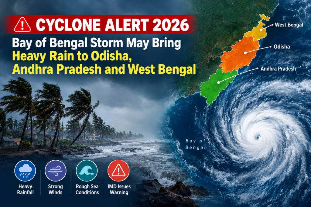
The weather pattern that has developed in the Bay of Bengal has caused an alert about the possible formation of a cyclonic storm in the upcoming days for which the Indian Meteorological Department (IMD) has issued a Cyclone Alert 2026. The coastal areas of Odisha and Andhra Pradesh are being closely watched whereas the coastal areas of West Bengal are also likely to witness changes in the weather pattern with rains.
According to the forecast of the IMD released on 23 October 2020, there is a likelihood of this low pressure area strengthening itself into a cyclonic storm in the next two days i.e. October 26 and after this it would head to the coasts of north Andhra Pradesh and south Odisha coast.
Bay of Bengal Cyclone Alert 2026: What Is the Latest Update?
The current weather system originated in the presence of a cyclonic circulation over southeast and adjoining east-central Bay of Bengal. The system is being observed for any further development.
The IMD prediction is that the following could happen:
- October 23: A low-pressure area has formed over the east-central and adjoining southeast Bay of Bengal.
- October 24: The system may intensify into a depression.
- October 25: It may strengthen into a deep depression.
- October 26: A cyclonic storm may develop over the west-central Bay of Bengal.
- October 27–28: The system may move towards the north Andhra Pradesh and adjoining south Odisha coasts.
Which States May Be Affected by Heavy Rainfall?
The potential effects will depend on the storm’s strength, direction and distance from the coast. Rainfall forecasts also vary by state and district.
1. Odisha
The state of Odisha is one of the states that are being observed because of the movement of the system towards its southern coast. According to the forecast from the IMD, there will be increased rainfall from October 26, and widespread rain and isolated heavy rainfall can be expected during October 27-29.
Moreover, thunderstorms and squally winds can occur in some areas of the state during this period. Coastal and low lying areas need to be on the lookout for any advisories, especially if the rainfall increases.
The public must secure their belongings, stay away from flooded streets, and comply with instructions coming from their respective local officials.
2. Andhra Pradesh
North Andhra Pradesh is yet another important region that needs to be watched carefully. The developing cyclonic storm system is likely to advance towards the coast of north Andhra Pradesh and neighboring south Odisha coast after possibly strengthening in the Bay of Bengal.
Heavy rain is likely to occur in coastal Andhra Pradesh and Yanam at places during the forecast period with very heavy rain at isolated places. High wind, thunderstorm, and rough sea may lead to problems for fishing operations and coastal navigation.
People in vulnerable areas need to make arrangements for their basic necessities and listen to advisories by the Andhra Pradesh State Disaster Management Authority and IMD.
3. West Bengal
West Bengal should also be watched out for, but their forecast must be carefully understood. According to the IMD’s Subdivision-wise forecast for October 23, there are chances of very heavy rainfall in the Gangetic West Bengal on October 28 and 29, along with thundershowers, lightening, or squally weather conditions.
It does not imply that all districts of the state will have bad weather or the formed cyclone will definitely landfall in West Bengal. The rain forecast and cyclone’s track are two different things.
People from Kolkata and other districts of south-western West Bengal should look into district-specific forecasts before planning anything. Any further advisory or warning issued by IMD and the state government should be considered ahead of news channels.
What Does an IMD Cyclone Warning Mean?
Cyclone alert does not always mean that the storm is already formed or the storm’s landing is about to take place. The development of weather patterns takes place in certain phases, and as more information comes up, their impact will become evident.
A low pressure pattern can be developed to become a depression, deep depression, and finally a cyclone storm. However, all low pressure does not develop into cyclones.
The IMD provides forecasts and alerts depending on the position of the system, its movement, intensity, and impacts it can cause.
For reliable information, readers can refer to the India Meteorological Department and follow local disaster management announcements rather than relying solely on social media posts.
Safety Precautions During a Cyclone Alert
Taking sensible precautions can help reduce risks, even when the final path of a weather system is uncertain.
Before heavy rain or strong winds
- Keep drinking water, essential medicines, a torch, batteries and a charged power bank ready.
- Secure outdoor furniture, loose roofing materials and other objects that strong winds could displace.
- Save emergency contact numbers and keep important documents in a waterproof bag.
- Check weather bulletins before travelling through coastal or flood-prone areas.
During thunderstorms and heavy rainfall
Do not stand under trees, or beside any unstable constructions or huge advertisement boards during windy weather. You should stay indoors during lightening and avoid exposed electricity sources.
Do not enter the flooded roads when the water level and strength of water are unknown. Such floods contain open drains and other dangers for you.
For fishermen and people living in coastal areas
You should obey the rules about fishing and other operations at sea and not go to sea areas which have warnings. Improvement of weather does not mean safety there.
Residents in the coastal areas, which are vulnerable to such disasters, should evacuate following the instructions of local authorities.
How Could the Developing Cyclone Affect Daily Activities?
Heavy rain can affect transport by road, the market, farming, and open-air activities. Urban areas may experience delayed traffic due to flooding, while windy conditions can cause damage to temporary structures and interruptions to power supply.
Agricultural workers need to watch out for weather predictions before engaging in such activities as spraying, harvesting, and any other farming activities done outdoors. Travelers need to confirm their travel arrangements and assess road conditions before embarking on their travels.
Those working in coastal regions can take advantage of contacting emergency numbers, protecting their equipment from flooding, and making arrangements for outdoor operations.
But the extent of this disruption will depend on how the storm develops. It is too early to make assumptions about damage when more accurate predictions are not yet available.
What Happens Next?
The coming days will be critical in determining whether the system formed in the Bay of Bengal develops into a cyclonic storm and how close it approaches the eastern coast.
The IMD will monitor its strength, trajectory, rainfall chances, and winds. The forecasts may change based on fresh data that emerges.
For those tracking news about the Odisha cyclone, Andhra Pradesh coastal weather forecast, and West Bengal weather forecast, staying updated through official sources is better than depending on one initial forecast.